Revolutionary "Publick" Claims series
To view a digital copy (pdf) of the index to this book, visit Index-Montgomery
(Close the pdf file with the left arrow to return to Iberian's catalog)
[Pc46] $6.00 (printed version)
The above title is also available as a digital e-book in PDF format:
[EPc46] $3.50 (electronic version)
For more records pertaining to MONTGOMERY COUNTY, VIRGINIA see also:
- MEN IN GRAY INTERMENTS series
and the following counties which once formed Greater Montgomery County at its inception:
- Giles, Pulaski, Wythe, Greenbrier, Buchanan, Craig, Floyd, Roanoke, Tazewell, Boone, Cabell, Fayette, Kanawha, Lincoln, Logan, McDowell, Mercer, Mingo, Raleigh, Summers, Wayne, and Wyoming Counties, plus the now extinct county of Fincastle.
- Guide to Virginia Militia Units in the War of 1812
Chart on the Formation of Virginia Counties
Atlas of County Boundary Changes in Virginia, 1634-1895
Index to the 1810 Virginia Census


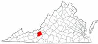 Montgomery County was established in 1776 from the northeastern part of Fincastle County (now abolished). The county's name honored General Richard Montgomery, killed during the assault on Quebec late in 1775. At the time of its creation, Montgomery covered nearly 12,000 square miles and extended westward to the Ohio River. In 1777 the western half of Montgomery was cut off to form Greenbrier County. Following this division, Montgomery County was still immense. Its territory included all or part of the following counties: Buchanan, Craig, Giles, Pulaski, Roanoke, Tazewell, Wythe and the West Virginia counties of Boone, Cabell, Fayette, Kanawha, Lincoln, Logan, McDowell, Mercer, Mingo, Raleigh, Summers, Wayne, and Wyoming.
A portion of Kanawha County was separated from Montgomery in 1788. In 1794 the boundary between Montgomery and Grayson was adjusted and the following year (1795) the line between Botetourt and Montgomery was altered slightly (a further alteration of this second line occurred in 1796) In 1808 Giles County was formed from part of Montgomery, followed by Floyd County in 1831. In 1839 another part of Montgomery was transferred to Floyd County. in 1840 a single farm was transferred back to Montgomery's control. In 1842 part of Pulaski County was given back to Montgomery. In 1849 Roanoke County annexed an adjacent portion of Montgomery lands and in 1853 part of Montgomery was added to form Craig County. Montgomery's boundaries stabilized at that point.
Montgomery County was established in 1776 from the northeastern part of Fincastle County (now abolished). The county's name honored General Richard Montgomery, killed during the assault on Quebec late in 1775. At the time of its creation, Montgomery covered nearly 12,000 square miles and extended westward to the Ohio River. In 1777 the western half of Montgomery was cut off to form Greenbrier County. Following this division, Montgomery County was still immense. Its territory included all or part of the following counties: Buchanan, Craig, Giles, Pulaski, Roanoke, Tazewell, Wythe and the West Virginia counties of Boone, Cabell, Fayette, Kanawha, Lincoln, Logan, McDowell, Mercer, Mingo, Raleigh, Summers, Wayne, and Wyoming.
A portion of Kanawha County was separated from Montgomery in 1788. In 1794 the boundary between Montgomery and Grayson was adjusted and the following year (1795) the line between Botetourt and Montgomery was altered slightly (a further alteration of this second line occurred in 1796) In 1808 Giles County was formed from part of Montgomery, followed by Floyd County in 1831. In 1839 another part of Montgomery was transferred to Floyd County. in 1840 a single farm was transferred back to Montgomery's control. In 1842 part of Pulaski County was given back to Montgomery. In 1849 Roanoke County annexed an adjacent portion of Montgomery lands and in 1853 part of Montgomery was added to form Craig County. Montgomery's boundaries stabilized at that point.
 WOLF HUNTERS ON THE VIRGINIA FRONTIER, 1776-1818 [bounty lists & certificates from Amherst, Augusta, Bath, Botetourt, Grayson, Greenbrier, Hampshire, Hardy, Mopntgomery, Patrick, Pendleton, Rockbridge, Russell, Shenandoah, Washington, and Wythe counties [dates vary] transcribed & edited by Karen Wagner Treacy. 8 1/2 x 11, vi, 169 pages, full name index.
  FINCASTLE AND MONTGOMERY COUNTIES DEEDS & WILLS B, 1773-1797 transcribed & edited by Karen Wagner Treacy. 10 1/2 x 8 1/2, vi, 232 pages, index.
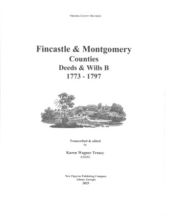
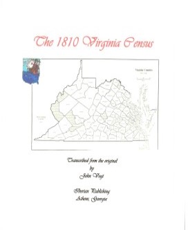 MONTGOMERY CO., VA 1810 CENSUS transcribed by John Vogt. 10 1/2 x 8 1/2, x, 39 pages, illustrations, maps, index. This is the first surviving
census for Montgomery, since both the 1790 and 1800 censuses have been lost. A full name index is provided.
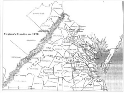
Montgomery was an important and populous county in the mountainous foothills of southwestern Virginia and it was situated along the Great Road or Valley Road as it was called, which stretched from Maryland to the Cumberland Gap and beyond into Tennessee and Kentucky.
MONTGOMERY CO., VA 1810 CENSUS transcribed by John Vogt. 10 1/2 x 8 1/2, x, 39 pages, illustrations, maps, index. This is the first surviving
census for Montgomery, since both the 1790 and 1800 censuses have been lost. A full name index is provided.
Montgomery was an important and populous county in the mountainous foothills of southwestern Virginia and it was situated along the Great Road or Valley Road as it was called, which stretched from Maryland to the Cumberland Gap and beyond into Tennessee and Kentucky.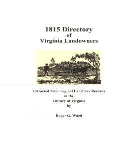 Montgomery Co. 1815 Directory of Landowners
by Roger G. Ward. 2005. 33 pages, map, 5 1/2X8 1/2.
Montgomery Co. 1815 Directory of Landowners
by Roger G. Ward. 2005. 33 pages, map, 5 1/2X8 1/2.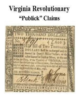 Montgomery Co. Revolutionary Public Claims
transcribed by Janice L. Abercrombie and Richard Slatten.. 2005. 21 pages, 5 1/2X8 1/2.
Montgomery Co. Revolutionary Public Claims
transcribed by Janice L. Abercrombie and Richard Slatten.. 2005. 21 pages, 5 1/2X8 1/2.