


Home
Reference
Census Records
Military
African-American
Other States
New Titles
E-BOOKS
FREE SHIPPING IN USA
Iberian Publishing Company's On-Line Catalog:
Giles County Virginia
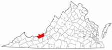 Giles County was formed in 1806 from portions of Monroe, Montgomery and Tazewell counties. It was named in honor of the current U.S. Senator from the state, William Branch Giles, who later became Governor of Virginia (1827-1830). At the time of its creation it contained portions of the following present-day counties: Bland, Criag, Mercer, Raleigh, Summers, and Wyoming.
In 1808 a small part of Wythe County was added to Giles. In 1824 some of Giles's land was transferred to newly-established Logan County. Another portion of Tazewell was added to Giles in 1826 and a portion of Monroe was added in 1829. In 1836 a farm of 337 acres was transferred from Tazewell jurisdiction to that of Giles.
In 1837 Mercer County was subdivided from Giles's and Tazewell's land. In 1841 a portion of Mercer County was transferred back to Giles. Craig County took another small part of Giles when it was created in 1851, and again in 1858 other Giles land went to Craig. Bland County's creation in 1861 took further portions of Giles, Tazewell and Wythe. In 1880 two farms in Craig County were transferred back to Giles. Thee final boundary adjustment came in 1900 whena small portion of Giles was transferred to Bland County.
The earliest known settlers in the region were a small group of Pennsylvanians who settled around Glen Lyn as early as 1742. Giles County was formed in 1806 from portions of Monroe, Montgomery and Tazewell counties. It was named in honor of the current U.S. Senator from the state, William Branch Giles, who later became Governor of Virginia (1827-1830). At the time of its creation it contained portions of the following present-day counties: Bland, Criag, Mercer, Raleigh, Summers, and Wyoming.
In 1808 a small part of Wythe County was added to Giles. In 1824 some of Giles's land was transferred to newly-established Logan County. Another portion of Tazewell was added to Giles in 1826 and a portion of Monroe was added in 1829. In 1836 a farm of 337 acres was transferred from Tazewell jurisdiction to that of Giles.
In 1837 Mercer County was subdivided from Giles's and Tazewell's land. In 1841 a portion of Mercer County was transferred back to Giles. Craig County took another small part of Giles when it was created in 1851, and again in 1858 other Giles land went to Craig. Bland County's creation in 1861 took further portions of Giles, Tazewell and Wythe. In 1880 two farms in Craig County were transferred back to Giles. Thee final boundary adjustment came in 1900 whena small portion of Giles was transferred to Bland County.
The earliest known settlers in the region were a small group of Pennsylvanians who settled around Glen Lyn as early as 1742.
For a better understanding of county boundary changes, see our new section Virginia in Maps
Iberian also has hundreds of titles in e book (PDF) format!! Click here for a complete online catalog of available titles
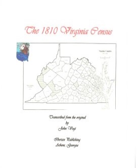 Giles County,Virginia 1810 Federal Census: A Transcription Giles County,Virginia 1810 Federal Census: A Transcription
John Vogt, 2009, x, 14 pp., 8x10 format, illustrations, maps. A faithful and accurate transcription of the first surviving census for this Virginia county.
[Gil10] $6.00 (printed version)
The above title is also available as a digital e-book in PDF format:
[EGIL10] $3.50 (electronic version)
GILES COUNTY MARRIAGES, 1806-1850
John Vogt & T. William Kethley, Jr. 1985, vii, 147 pages, indices, figure, map. Giles County was established in 1806 from Montgomery County and portions of Monroe and
Tazewell counties. Parts of Wythe, Monroe, Mercer, Craig and Tazewell were added later. The 1,498 marriage
records in this volume are particularly complete and contain both ministers' returns and surety bonds.
Accompanying data in most records includes minister's name, bondsman, and occasionally parents and relatives'
names.
[Gile] $20.00
The above title is also available as a digital e-book in PDF format:
[EGILE] $12.00 (electronic version)
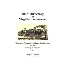 Giles Co. 1815 Directory of Landowners
by Roger G. Ward. 2005. 21 pages, map, 5 1/2X8 1/2. Giles Co. 1815 Directory of Landowners
by Roger G. Ward. 2005. 21 pages, map, 5 1/2X8 1/2.
For a full description of the 1815 LAND DIRECTORY Records and a listing of available counties, see:
Individual County Booklets, 1815 Directory of Virginia Landowners
[Vd30] $7.00
The above title is also available as a digital e-book in PDF format:
[EVd30] $4.50 (electronic version)
For more records pertaining to GILES COUNTY, VIRGINIA see also:
    
Please see our HELP PAGE for mail-order instructions, wholesaler policies and other contact information.
|| Virginia/W.Va. || General Reference || Military Records ||
|| Other States || E-Books || New Titles || Home Page || E-Books ||
Copyright 2026 Iberian Publishing Company
|