For more records pertaining to PULASKI COUNTY, VIRGINIA see also: MEN IN GRAY INTERMENTS series Montgomery County series Wythe County series Guide to Virginia Militia Units in the War of 1812 Chart on the Formation of Virginia Counties Atlas of County Boundary Changes in Virginia, 1634-1895 Index to the 1810 Virginia Census Please see our HELP PAGE for mail-order instructions, wholesaler policies and other contact information. || Virginia/W.Va. || General Reference || Military Records || || Other States || E-Books || New Titles || Home Page || E-Books || Copyright 2026 Iberian Publishing Company
Please see our HELP PAGE for mail-order instructions, wholesaler policies and other contact information.
Copyright 2026 Iberian Publishing Company


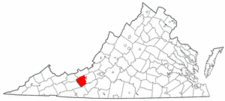 Pulaski County was formed in 1839 from the western portion of Montgomery and the eastern portion of Wythe counties. The county was named for Count Casimir Pulaski, the Polish patriot who served in the American army during the Revolutionary War and who was killed at the siege of Savannah in 1779. In 1842 a small portion of territory was returned to Montgomery County.