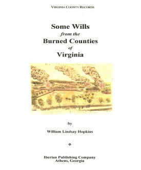
 SOME WILLS FROM THE BURNED COUNTIES OF VIRGINIA
compiled by William Lindsay Hopkins. 6x9 format. Wills from circa 1670-1830 for the counties of Brunswick, Buckingham, Caroline, Charles City, Dinwiddie, Elizabeth City,
Gloucester, Hanover, Henrico, James City, King George, King and Queen, King William, Mathews,
Nansemond, New Kent, Prince George, Prince William, Stafford, and Warwick Counties, Va.
SOME WILLS FROM THE BURNED COUNTIES OF VIRGINIA
compiled by William Lindsay Hopkins. 6x9 format. Wills from circa 1670-1830 for the counties of Brunswick, Buckingham, Caroline, Charles City, Dinwiddie, Elizabeth City,
Gloucester, Hanover, Henrico, James City, King George, King and Queen, King William, Mathews,
Nansemond, New Kent, Prince George, Prince William, Stafford, and Warwick Counties, Va.
To view a digital copy of the index to this book, visit Index-Swbc
(Use your back arrow to return to Iberian's catalog)
[Swbc] $32.00 (printed version)
The above title is also available as a digital e-book in PDF format:
[ESwbc] $20.00 (electronic version)
For more records pertaining to STAFFORD COUNTY, VIRGINIA see also:


Please see our HELP PAGE for mail-order instructions, wholesaler policies and other contact information.
|| Virginia/W.Va. || General Reference || Military Records ||
|| Other States || E-Books || New Titles || Home Page || E-Books ||
Copyright 2026 Iberian Publishing Company


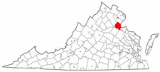 Stafford County was formed in 1664 from the upper portion of Westmoreland County. As initially created, it included all of the land from the Potomac River westward to the dividing ridge of the watershed between the Potomac and Rappahannock rivers. Stafford's lands north of Chapawamisck Creek were cut off to create part of Prince William County in 1730. In 1776 the boundaries of Stafford and King George counties were greaty altered so that the dividing line ran from the Potomac River to the Rappahannock River rather than along the watershed ridge line. The lower portion of Stafford became part of King George and the upper half of King George was transferred to Stafford's administration.
Many of Stafford's county court records were vandalized by Federal occupation troops during the Civil War.
Stafford County was formed in 1664 from the upper portion of Westmoreland County. As initially created, it included all of the land from the Potomac River westward to the dividing ridge of the watershed between the Potomac and Rappahannock rivers. Stafford's lands north of Chapawamisck Creek were cut off to create part of Prince William County in 1730. In 1776 the boundaries of Stafford and King George counties were greaty altered so that the dividing line ran from the Potomac River to the Rappahannock River rather than along the watershed ridge line. The lower portion of Stafford became part of King George and the upper half of King George was transferred to Stafford's administration.
Many of Stafford's county court records were vandalized by Federal occupation troops during the Civil War.
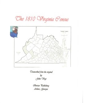 STAFFORD CO., VA 1810 CENSUS transcribed, with an index by John Vogt. 2010, 10 1/2 x 8 1/2, x, 25 pages, illustrations, maps, index. This is the first surviving census for Stafford, since both the 1790 and 1800 censuses have been lost. A complete index is included for easy access.
Stafford was one of the earliest counties in the area known as the Northern Neck, and it was settled under the auspices of Lord Fairfax pursuant to his grant. The county's location along the Potomac and Rappahannock Rivers gave it added importance as a commercial center, and the town of Falmouth was an important shipping center for the region.
STAFFORD CO., VA 1810 CENSUS transcribed, with an index by John Vogt. 2010, 10 1/2 x 8 1/2, x, 25 pages, illustrations, maps, index. This is the first surviving census for Stafford, since both the 1790 and 1800 censuses have been lost. A complete index is included for easy access.
Stafford was one of the earliest counties in the area known as the Northern Neck, and it was settled under the auspices of Lord Fairfax pursuant to his grant. The county's location along the Potomac and Rappahannock Rivers gave it added importance as a commercial center, and the town of Falmouth was an important shipping center for the region.
 THE 47th VIRGINIA INFANTRY
by Homer D. Musselman. 2nd edition, 2010. Paperback, 6x9, x, 228 pp, illustrations, maps, color photos. This definitive study of the 47th Va. Infantry was first published in 1991, and today copies of the original volume are on the used book market for more than two hundred dollars. The author has continued his research into the unit's history and has significantly expanded the original, especially in the unit roster. Like its predecessor, this work is destined to become the definitive study on this element of Civil War history.
THE 47th VIRGINIA INFANTRY
by Homer D. Musselman. 2nd edition, 2010. Paperback, 6x9, x, 228 pp, illustrations, maps, color photos. This definitive study of the 47th Va. Infantry was first published in 1991, and today copies of the original volume are on the used book market for more than two hundred dollars. The author has continued his research into the unit's history and has significantly expanded the original, especially in the unit roster. Like its predecessor, this work is destined to become the definitive study on this element of Civil War history.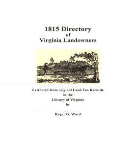 Stafford Co. 1815 Directory of Landowners
by Roger G. Ward. 2005. 15 pages, map, 5 1/2X8 1/2.
Stafford Co. 1815 Directory of Landowners
by Roger G. Ward. 2005. 15 pages, map, 5 1/2X8 1/2.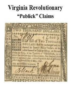 Stafford Co. Revolutionary Public Claims
transcribed by Janice L. Abercrombie and Richard Slatten.. 2005. 45 pages, 5 1/2X8 1/2.
Stafford Co. Revolutionary Public Claims
transcribed by Janice L. Abercrombie and Richard Slatten.. 2005. 45 pages, 5 1/2X8 1/2.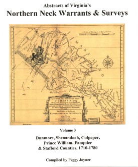 NORTHERN NECK (LAND) WARRANTS & SURVEYS, 1710-1780: DUNMORE, SHENANDOAH, CULPEPER, PRINCE WILLIAM, FAUQUIER & STAFFORD COUNTIES by Peggy Shomo Joyner.
1986, xx, 197 pp., map, illust. Published as the third volume in a series of Northern Neck Warrants & Surveys, this collection has become a standard reference work for researchers in the period of colonial Virginia history for this area.
NORTHERN NECK (LAND) WARRANTS & SURVEYS, 1710-1780: DUNMORE, SHENANDOAH, CULPEPER, PRINCE WILLIAM, FAUQUIER & STAFFORD COUNTIES by Peggy Shomo Joyner.
1986, xx, 197 pp., map, illust. Published as the third volume in a series of Northern Neck Warrants & Surveys, this collection has become a standard reference work for researchers in the period of colonial Virginia history for this area.