


Home
Reference
Census Records
Military
African-American
Other States
New Titles
E-BOOKS
FREE SHIPPING IN USA
Iberian Publishing Company's On-Line Catalog:
Richmond City Virginia
In 1737 Major William Mayo laid off lots for the Town of Richmond, Virginia on William Byrd II's property at the falls of the James River in Henrico County. The new town was named for its supposed resemblance to Richmond on the Thames, near London. Richmond was incorporated as a town by the General Assembly in 1742, but it remained a part of Henrico County. Then in 1782 Richmond was chartered as an independent city. It had become the state capital in 1780 and between 1861 and 1865 Richmond served as the capital of the Confederacy. Much of the town was destroyed in the Confederate retreat from the city in April, 1865 and numerous early records were destroyed.
The town of Manchester was annexed to Richmond in 1910, and the adjoining communities of Barton Heights, Fairmount, and Highland Park were annexed in 1914, thereby extending the city's northern border. A further annexation from Chesterfield County in 1970 brought the city to its current size of 62.5 square miles.
Richmond's surviving court records date from 1782 for land and court records, 1797 for marriage records, and 1810 for probate records. For additional extant records, see Henrico County.
Richmond was a very cosmopolitan place for a small town during the Revolutionary and post-Revolutionary decades with numerous persons from other states and cities resident there. A large settlement of Scotch, Irish, and Germans added to the cosmopolitan nature of the new capital. In addition, many planters and state officials as well as numerous merchants maintained homes within the city.
For a better understanding of county boundary changes, see our new section Virginia in Maps
Iberian also has hundreds of titles in e book (PDF) format!! Click here for a complete online catalog of available titles
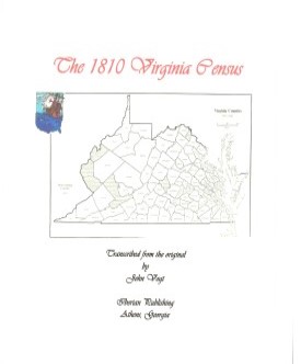 THE INDEPENDENT CITY OF RICHMOND, VA 1810 CENSUS transcribed by John Vogt. 2009, 8 x 10, x, 38 pages, illustrations, maps, index.Richmond's 1810 census is the first real glimpse we have from the census records of this "cosmpolitan" town of slightly more than nine thousand inhabitants, which in 1810 was entering its fourth decade as the capital of Virginia. Richmond was an area very differenct from its surrounding rural counties. 1,298 households made up the state's capital, with property ranging from single dwellings to landed estates of many acres. What had begun as a town laid out in 32 two-acre squares, each with four lots, and adjoining suburban land, had grown considerably by 1810. In 1742 Richmond was officialy designated as a town, and its new role as the state capital began in April 1780.
By any definition, Richmond was rapidly becoming an urban center by 1810. In the rush of building, tanyards and lumberhouses stood cheek by jowl with fine residences, taverns, and stables. Richmond was a major import center, and the activity along the banks of the James River continued day and night. A little farther north, just beyond the Capitol grounds, stood many fine homes of the more wealthy inhabitants. A number of persons maintained "plantations-in-town" in this area.. For example, Chief Justice John Marshall owned a square in the fashionable residential area known as Court End. Many of his friends and relatives bought four lots that comprised a square or city block. These properties, which included their homes, supported buildings and gardens. Marshall's square, for example, included his residence, his law office, a laundry, kitchen, carriage house and stable, garden and carriage turn-around. Another point about Richmond was its preponderant African-American population. One in five of Richmond's inhabitants was either a freed slave or a freedman of long standing. And fully fifty percent of the total population was of African-American descent [cf. statistical summary].
When a family name is encountered in a community such as Richmond, the first question which comes to mind is "What part of the city did he or she live in?" While wills and deeds can give a good picture of the location, another good source to use as a supplement is the 1815 land tax. While land taxes have been around as long as the state itself, 1815 was the first year in which the resident was identified by distance and direction from the courthouse, as well as the prominent watercourse or geographic landmark near his residence. By checking with this land tax, which does not include all of the census names but does include the actual owners of property, a good idea of where an ancestor resided can often be obtained. This is particularly valuable for Richmond, since it appears that the census taker recorded his entries as he encountered them in his travels. Thus, entries carry some geographical relationship to one another. David Price, the enumerator, began his journey at the old penitentiary in the southwest corner of the city, and the reader can see the city through the changes in population as he traversed the waterfront areas, the packed residential districts for workers, and finally the well-manicured lawns of the wealthy of the city. The reader can see the families living in Adams Valley, as well as the suburbanites in the western tracts of Martin Baker and along Old Brook Road at the extreme northwest corner of the city near Bacon's Branch. Many of the entries in the land tax list for the city gives occupations as well as brief locations. Land tax list for 1815 for every Virginia county existing at that time have been published by Roger G. Ward and are available through New Papyrus Publishing Company. THE INDEPENDENT CITY OF RICHMOND, VA 1810 CENSUS transcribed by John Vogt. 2009, 8 x 10, x, 38 pages, illustrations, maps, index.Richmond's 1810 census is the first real glimpse we have from the census records of this "cosmpolitan" town of slightly more than nine thousand inhabitants, which in 1810 was entering its fourth decade as the capital of Virginia. Richmond was an area very differenct from its surrounding rural counties. 1,298 households made up the state's capital, with property ranging from single dwellings to landed estates of many acres. What had begun as a town laid out in 32 two-acre squares, each with four lots, and adjoining suburban land, had grown considerably by 1810. In 1742 Richmond was officialy designated as a town, and its new role as the state capital began in April 1780.
By any definition, Richmond was rapidly becoming an urban center by 1810. In the rush of building, tanyards and lumberhouses stood cheek by jowl with fine residences, taverns, and stables. Richmond was a major import center, and the activity along the banks of the James River continued day and night. A little farther north, just beyond the Capitol grounds, stood many fine homes of the more wealthy inhabitants. A number of persons maintained "plantations-in-town" in this area.. For example, Chief Justice John Marshall owned a square in the fashionable residential area known as Court End. Many of his friends and relatives bought four lots that comprised a square or city block. These properties, which included their homes, supported buildings and gardens. Marshall's square, for example, included his residence, his law office, a laundry, kitchen, carriage house and stable, garden and carriage turn-around. Another point about Richmond was its preponderant African-American population. One in five of Richmond's inhabitants was either a freed slave or a freedman of long standing. And fully fifty percent of the total population was of African-American descent [cf. statistical summary].
When a family name is encountered in a community such as Richmond, the first question which comes to mind is "What part of the city did he or she live in?" While wills and deeds can give a good picture of the location, another good source to use as a supplement is the 1815 land tax. While land taxes have been around as long as the state itself, 1815 was the first year in which the resident was identified by distance and direction from the courthouse, as well as the prominent watercourse or geographic landmark near his residence. By checking with this land tax, which does not include all of the census names but does include the actual owners of property, a good idea of where an ancestor resided can often be obtained. This is particularly valuable for Richmond, since it appears that the census taker recorded his entries as he encountered them in his travels. Thus, entries carry some geographical relationship to one another. David Price, the enumerator, began his journey at the old penitentiary in the southwest corner of the city, and the reader can see the city through the changes in population as he traversed the waterfront areas, the packed residential districts for workers, and finally the well-manicured lawns of the wealthy of the city. The reader can see the families living in Adams Valley, as well as the suburbanites in the western tracts of Martin Baker and along Old Brook Road at the extreme northwest corner of the city near Bacon's Branch. Many of the entries in the land tax list for the city gives occupations as well as brief locations. Land tax list for 1815 for every Virginia county existing at that time have been published by Roger G. Ward and are available through New Papyrus Publishing Company.
Surnames and miscellaneous data included in the Richmond City 1810 Census are available here: Surname list
[RCH10] $11.00 (printed version)
The above title is also available as a digital e-book in PDF format:
[ERCH10] $8.00 (electronic version)
CITY OF RICHMOND, VA WILLS, 1782-1810
by Benjamin B. Weisiger, III, 1983. 55 pages, index.
Richmond, in Henrico County, became a town in 1742 and a city in 1782 at which time its records started.
Until 1810 the wills are found in the Hustings Court Deed Books.
To view a digital copy of the index to this book, visit Index-Rchw
(Use your back arrow to return to Iberian's catalog)
[Rchw] $14.95
The above title is also available as a digital e-book in PDF format:
[ERCHW] $10.00 (electronic version)
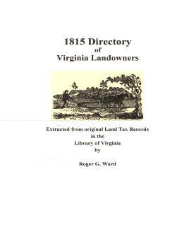 RICHMOND CITY 1815 Directory of Landowners
by Roger G. Ward. 2005. 33 pages, map, 5 1/2X8 1/2. RICHMOND CITY 1815 Directory of Landowners
by Roger G. Ward. 2005. 33 pages, map, 5 1/2X8 1/2.
For a full description of the 1815 LAND DIRECTORY Records and a listing of available counties, see:
Individual County Booklets, 1815 Directory of Virginia Landowners
[Vd47] $8.00
The above title is also available as a digital e-book in PDF format:
[EVd47] $5.50 (electronic version)
For more records pertaining to the Independent City of Richmond, VIRGINIA
see:
Guide to Virginia Militia Units in the War of 1812
Chart on the Formation of Virginia Counties
Atlas of County Boundary Changes in Virginia, 1634-1895
Index to the 1810 Virginia Census
    
Please see our HELP PAGE for mail-order instructions, wholesaler policies and other contact information.
|| Virginia/W.Va. || General Reference || Military Records ||
|| Other States || E-Books || New Titles || Home Page || E-Books ||
Copyright 2026 Iberian Publishing Company
|