Iberian Publishing Company's On-Line Catalog: Nottoway County Virginia
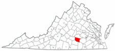
Nottoway County was formed in 1788 from the southern portion of lands belonging to Amelia County. The new county was named for an Indian tribe (Nadowa) which had lived in the vicinity. In 1792 the boundary between these two counties was adjusted to conform to the existing line between Raleigh and Nottoway parishes; the county has remained stable since.
During the final week of the Civil War, in April 1865, Federal troops raided the Nottoway clerk's office and hacked the record books with sabers; they then threw the mutilated volumes into a horse trough. Several early order books, deed and will books, were badly mutilated, and marriage records prior to 1865 were destroyed through this senseless vandalism.


 Nottoway County was formed in 1788 from the southern portion of lands belonging to Amelia County. The new county was named for an Indian tribe (Nadowa) which had lived in the vicinity. In 1792 the boundary between these two counties was adjusted to conform to the existing line between Raleigh and Nottoway parishes; the county has remained stable since.
During the final week of the Civil War, in April 1865, Federal troops raided the Nottoway clerk's office and hacked the record books with sabers; they then threw the mutilated volumes into a horse trough. Several early order books, deed and will books, were badly mutilated, and marriage records prior to 1865 were destroyed through this senseless vandalism.
Nottoway County was formed in 1788 from the southern portion of lands belonging to Amelia County. The new county was named for an Indian tribe (Nadowa) which had lived in the vicinity. In 1792 the boundary between these two counties was adjusted to conform to the existing line between Raleigh and Nottoway parishes; the county has remained stable since.
During the final week of the Civil War, in April 1865, Federal troops raided the Nottoway clerk's office and hacked the record books with sabers; they then threw the mutilated volumes into a horse trough. Several early order books, deed and will books, were badly mutilated, and marriage records prior to 1865 were destroyed through this senseless vandalism.
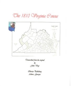 Nottoway County,Virginia 1810 Federal Census: A Transcription
 SOME EARLY LANDOWNERS IN SOUTHERN NOTTOWAY AND NORTHERN LUNENBURG COUNTIES, VIRGINIA AND THE COCKE (COKE) FAMILY WHO ONCE LIVED THERE
by Ben H. Coke, 1997. 138 pages, maps, index. Ben Coke provides the reader with the ability to locate eighteenth-century residents of this are
in a number of ways: through the tract itself, where the tract, year, grantor, grantee, acreage,
and source are listed; through an alphabetic listing of grantees with the same essential
information; and a listing of grantors; In addition, there are a number of topographic maps, plus
name and plat indices at the end. Anyone with early landowning colonial family in the region
will welcome this study.
SOME EARLY LANDOWNERS IN SOUTHERN NOTTOWAY AND NORTHERN LUNENBURG COUNTIES, VIRGINIA AND THE COCKE (COKE) FAMILY WHO ONCE LIVED THERE
by Ben H. Coke, 1997. 138 pages, maps, index. Ben Coke provides the reader with the ability to locate eighteenth-century residents of this are
in a number of ways: through the tract itself, where the tract, year, grantor, grantee, acreage,
and source are listed; through an alphabetic listing of grantees with the same essential
information; and a listing of grantors; In addition, there are a number of topographic maps, plus
name and plat indices at the end. Anyone with early landowning colonial family in the region
will welcome this study.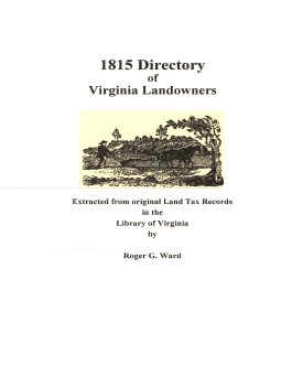 Nottoway Co. 1815 Directory of Landowners
by Roger G. Ward. 2005. 15 pages, map, 5 1/2X8 1/2.
Nottoway Co. 1815 Directory of Landowners
by Roger G. Ward. 2005. 15 pages, map, 5 1/2X8 1/2.