


Home
Reference
Census Records
Military
African-American
Other States
New Titles
E-BOOKS
FREE SHIPPING IN USA
Iberian Publishing Company's On-Line Catalog:
Jefferson County Virginia
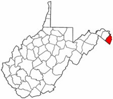 Jefferson County, created in 1801 and named for the then Vice-President of the United States and newly-elected President, had been a region of settlement for more than six decades before its formal organization. As early as the 1730 emigrant from Pennsylvania, were crossing the Potomac at Packhorse Ford below Shepherdstown (three decades before the ferries were established there and at Harper's Ferry), and moving into the region. Many of the early settlers were bound for the lands further up the Valley in what is today Shenandoah and Page Counties. But the fertility and beauty of the region caused many to pause, have the land surveyed, and petition for grants from Thomas Lord Fairfax. At the time the region was still part of Orange County, and some of these early deeds are to be found in Orange County and later Frederick County archives.
The region also benefitted from the main east-west road which ran from Alexandria through the Old Court House (Tyson's Corner) to Leesburg, and through the Blue Ridge at Keys Gap. Numbers of Loudoun settlers moved westward along this route to Jefferson in the years following the Revolution.
When Jefferson was created, it was taken from the territory of Berkeley County, and it was one of the triumvirate of counties (Berkeley, Jefferson, and Morgan) taken from Virginia following the Civil War and annexed to the new state of West Virginia. Jefferson County, created in 1801 and named for the then Vice-President of the United States and newly-elected President, had been a region of settlement for more than six decades before its formal organization. As early as the 1730 emigrant from Pennsylvania, were crossing the Potomac at Packhorse Ford below Shepherdstown (three decades before the ferries were established there and at Harper's Ferry), and moving into the region. Many of the early settlers were bound for the lands further up the Valley in what is today Shenandoah and Page Counties. But the fertility and beauty of the region caused many to pause, have the land surveyed, and petition for grants from Thomas Lord Fairfax. At the time the region was still part of Orange County, and some of these early deeds are to be found in Orange County and later Frederick County archives.
The region also benefitted from the main east-west road which ran from Alexandria through the Old Court House (Tyson's Corner) to Leesburg, and through the Blue Ridge at Keys Gap. Numbers of Loudoun settlers moved westward along this route to Jefferson in the years following the Revolution.
When Jefferson was created, it was taken from the territory of Berkeley County, and it was one of the triumvirate of counties (Berkeley, Jefferson, and Morgan) taken from Virginia following the Civil War and annexed to the new state of West Virginia.
For a better understanding of county boundary changes, see our new section Virginia in Maps
Iberian also has hundreds of titles in e book (PDF) format!! Click here for a complete online catalog of available titles
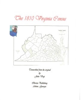 Jefferson County,Virginia 1810 Federal Census: A Transcription Jefferson County,Virginia 1810 Federal Census: A Transcription
John Vogt, 2008, x, 35 pp., 8x10 format, illustrations, maps, full name index. A faithful and accurate transcription of the first surviving census for this Virginia county. It includes not only the rural areas of the county, but separate listings for the communities of Charles Town, Smithfield, Harpers Ferry, and Shepherds Town.
[JF10] $11.00 (printed version)
The above title is also available as a digital e-book in PDF format:
[EJF10] $8.00 (electronic version)
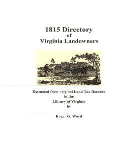 Jefferson Co. 1815 Directory of Landowners
by Roger G. Ward. 2005. 27 pages, map, 5 1/2X8 1/2. Jefferson Co. 1815 Directory of Landowners
by Roger G. Ward. 2005. 27 pages, map, 5 1/2X8 1/2.
For a full description of the 1815 LAND DIRECTORY Records and a listing of available counties, see:
Individual County Booklets, 1815 Directory of Virginia Landowners
[Vd52] $8.00
The above title is also available as a digital e-book in PDF format:
[EVd52] $6.00 (electronic version)
For records pertaining to JEFFERSON COUNTY, VIRGINIA see:
Chart on the Formation of Virginia Counties
Atlas of County Boundary Changes in Virginia, 1634-1895
Index to the 1810 Virginia Census
    
Please see our HELP PAGE for mail-order instructions, wholesaler policies and other contact information.
|| Virginia/W.Va. || General Reference || Military Records ||
|| Other States || E-Books || New Titles || Home Page || E-Books ||
Copyright 2026 Iberian Publishing Company
|