BOTETOURT CO., VA MARRIAGES, 1770-1853
John Vogt & T. William Kethley, Jr. Two volumes, 1987, xi, 600 pages, figures, appendices,
map. Originally composed of the southern portion of Augusta County, Botetourt became the
parent county for a total of forty-four counties, including much of the West Virginia area. Bonds,
ministers' returns, and miscellaneous marriage data have been collected from the records in the
Virginia State Library, Archives Division, and from courthouse sources to comprise the 5,211
marriage records.
Surname list
[Bote] two-volume set 35.00
The above title is also available as a digital e-book in PDF format:
[EBOTE] $22.00 (electronic version)
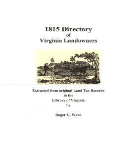 Botetourt Co. 1815 Directory of Landowners
by Roger G. Ward. 2005. 41 pages, map, 5 1/2X8 1/2.
Botetourt Co. 1815 Directory of Landowners
by Roger G. Ward. 2005. 41 pages, map, 5 1/2X8 1/2.
For a full description of the 1815 LAND DIRECTORY Records and a listing of available counties, see:
Individual County Booklets, 1815 Directory of Virginia Landowners
[Vd10] $9.00
The above title is also available as a digital e-book in PDF format:
[EVd10] $6.00 (electronic version)
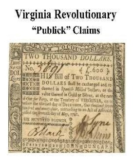 Botetourt Co. Revolutionary Public Claims
transcribed by Janice L. Abercrombie and Richard Slatten.. 2005. 49 pages, 5 1/2X8 1/2.
Botetourt Co. Revolutionary Public Claims
transcribed by Janice L. Abercrombie and Richard Slatten.. 2005. 49 pages, 5 1/2X8 1/2.
For a full description of the Virginia Revolutionary Public Claims and a listing of available counties, see:
Revolutionary "Publick" Claims series
To view a digital copy (pdf) of the index to this book, visit Index-Botetourt
(Close the pdf file with the left arrow to return to Iberian's catalog)
[Pc08] $7.75 (printed version)
The above title is also available as a digital e-book in PDF format:
[EPc08] $4.50 (electronic version)
For more records pertaining to BOTETOURT
COUNTY, VIRGINIA see also:
Guide to Virginia Militia Units in the War of 1812


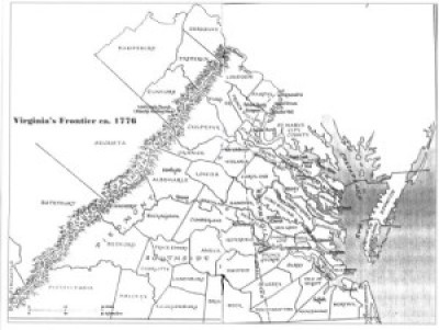
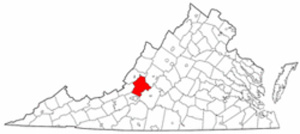 Botetourt County was created on 31 Jan. 1770 from the southern lands of Augusta County. Named for Lord Botetourt (Norborne Berkeley), governor of Virginia, 1768-1779, it encompassed all of Virginia (and West Virginia) west of the Blue Ridge and south of a line through the center of Rockbridge and west. This also included Virginia's lands in Kentucky, West Virginia, Ohio, Indiana, Illinois, and a portion of Wisconsin; however, its political control did not reach to these uttermost limits.
The process of dividing the county began in 1772 with the separation of Fincastle County. In 1778 Rockbridge County was formed from Augusta and Botetourt and Greenbrier County in the west was created brom Botetourt and Montgomery. In 1785 a portion of Rockbridge west of the ridgeline of Top Mountain was transferred to Botetourt's jurisdiction; in 1790 some of the southern part of Botetourt was transferred to Montgomery County. In 1790 and 1796 minor boundary alterations with Montgomery were effected. In 1791 Botetourt, along with Augusta and Greenbrier counties, contributed territory to form Bath County. In 1802 part of Botetourt was added to Monroe County. Alleghany was established in 1822 from portions of Botetourt, Bath, and Monroe Counties; 1838, Roanoke County was cut off, and in 1851 Craig County was formed from parts of Botetourt, Giles, Roanoke, and Monroe counties. The final boundary change came in 1888 when the line between Rockbridge and Botetourt south of the James River was changed and a small amount of land was transferred to Roanoke's jurisdiction.
Botetourt's location astride the Old Carolina Wagon Road made it an important county genealogically. Settlers from the Shenandoah Valley and Pennsylvania had to pass through the area on their way to the Yadkin Valley and central North Carolina. It was also the area to which many immigrant workers came in the nineteenth century to labor on the Kanawha Canal and to work in the iron foundry at Cloverdale Furnace.
Botetourt County was created on 31 Jan. 1770 from the southern lands of Augusta County. Named for Lord Botetourt (Norborne Berkeley), governor of Virginia, 1768-1779, it encompassed all of Virginia (and West Virginia) west of the Blue Ridge and south of a line through the center of Rockbridge and west. This also included Virginia's lands in Kentucky, West Virginia, Ohio, Indiana, Illinois, and a portion of Wisconsin; however, its political control did not reach to these uttermost limits.
The process of dividing the county began in 1772 with the separation of Fincastle County. In 1778 Rockbridge County was formed from Augusta and Botetourt and Greenbrier County in the west was created brom Botetourt and Montgomery. In 1785 a portion of Rockbridge west of the ridgeline of Top Mountain was transferred to Botetourt's jurisdiction; in 1790 some of the southern part of Botetourt was transferred to Montgomery County. In 1790 and 1796 minor boundary alterations with Montgomery were effected. In 1791 Botetourt, along with Augusta and Greenbrier counties, contributed territory to form Bath County. In 1802 part of Botetourt was added to Monroe County. Alleghany was established in 1822 from portions of Botetourt, Bath, and Monroe Counties; 1838, Roanoke County was cut off, and in 1851 Craig County was formed from parts of Botetourt, Giles, Roanoke, and Monroe counties. The final boundary change came in 1888 when the line between Rockbridge and Botetourt south of the James River was changed and a small amount of land was transferred to Roanoke's jurisdiction.
Botetourt's location astride the Old Carolina Wagon Road made it an important county genealogically. Settlers from the Shenandoah Valley and Pennsylvania had to pass through the area on their way to the Yadkin Valley and central North Carolina. It was also the area to which many immigrant workers came in the nineteenth century to labor on the Kanawha Canal and to work in the iron foundry at Cloverdale Furnace.
 WOLF HUNTERS ON THE VIRGINIA FRONTIER, 1776-1818 [bounty lists & certificates from Amherst, Augusta, Bath, Botetourt, Grayson, Greenbrier, Hampshire, Hardy, Mopntgomery, Patrick, Pendleton, Rockbridge, Russell, Shenandoah, Washington, and Wythe counties [dates vary] transcribed & edited by Karen Wagner Treacy. 8 1/2 x 11, vi, 169 pages, full name index.
  BOTETOURT CO., VA COURT ORDERS, 1770-1771 transcribed and edited by Karen Wagner Treacy. 10 1/2 x 8 1/2, iV, 426 pages. A transformation was taking place in the western counties of Virginia, as thousands of settlers moved into and through the area in search of new lands. Botetourt's position along the major routes south and west was a central focal point of this migration. The author has examined and transcribed the first court order book for the county, which includes the initial sttlers at the time of the county's creation as well as those who had settled pre-emptively during earlier years. Numerous litigations, especially for debt, are recorded in this first year of the order book.
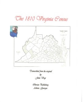 BOTETOURT CO., VA 1810 CENSUS transcribed by John Vogt. 10 1/2 x 8 1/2, x, 37 pages. This is the first surviving
census for Botetourt, since both the 1790 and 1800 censuses have been lost. The transcription is in the rough alpha order of the original document for easy reference.
Botetourt was an important and populous county in the mountainous foothills of southwestern Virginia and it was situated along two main thoroughfares westward, the Valley Road and the
east-west Buckingham Road from the coast.
BOTETOURT CO., VA 1810 CENSUS transcribed by John Vogt. 10 1/2 x 8 1/2, x, 37 pages. This is the first surviving
census for Botetourt, since both the 1790 and 1800 censuses have been lost. The transcription is in the rough alpha order of the original document for easy reference.
Botetourt was an important and populous county in the mountainous foothills of southwestern Virginia and it was situated along two main thoroughfares westward, the Valley Road and the
east-west Buckingham Road from the coast.