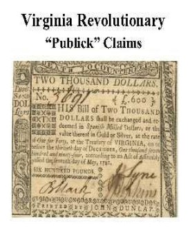
 Amherst Co. Revolutionary Public Claims
transcribed by Janice L. Abercrombie and Richard Slatten.. 2005. 50 pages, 5 1/2X8 1/2.
Amherst Co. Revolutionary Public Claims
transcribed by Janice L. Abercrombie and Richard Slatten.. 2005. 50 pages, 5 1/2X8 1/2.
For a full description of the Virginia Revolutionary Public Claims and a listing of available counties, see:
Revolutionary "Publick" Claims series
To view a digital copy (pdf) of the index to this book, visit Index-Amherst
(Close the pdf file with the left arrow to return to Iberian's catalog)
[Pc04] $7.75 (printed version)
The above title is also available as a digital e-book in PDF format:
[EPc04] $4.65 (electronic version)
For other records pertaining to Amherst COUNTY, VIRGINIA see:


Please see our HELP PAGE for mail-order instructions, wholesaler policies and other contact information.
|| Virginia/W.Va. || General Reference || Military Records ||
|| Other States || E-Books || New Titles || Home Page || E-Books ||
Copyright © 2026 Iberian Publishing Company


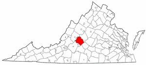 Amherst County was formed on 1 May 1761 from territory then part of Albemarle County. It was so named for Major General Jeffrey Amherst, who had commanded the British forces in the colony during the latter part of the French and Indian War, and governor of Virginia from 1759 to 1768. The new county then included territory in the present counties of both Amherst and Nelson. Augusta County formed its western and northern boundary until Rockbridge replaced it in 1778; on the east Amherst was bounded by Albemarle County. In 1769, the Virginia General Assembly settled a dispute between Albemarle and Amherst by dividing the jurisdiction of certain islands in the James River between these two counties. To the south, Amherst was separated from Buckingham and Bedford (after 1782, Campbell) by the James River.
Nelson County was separated from Amherst in 1808 from the northern part of Amherst. At that time Amherst reached its current configuration.
Amherst County was formed on 1 May 1761 from territory then part of Albemarle County. It was so named for Major General Jeffrey Amherst, who had commanded the British forces in the colony during the latter part of the French and Indian War, and governor of Virginia from 1759 to 1768. The new county then included territory in the present counties of both Amherst and Nelson. Augusta County formed its western and northern boundary until Rockbridge replaced it in 1778; on the east Amherst was bounded by Albemarle County. In 1769, the Virginia General Assembly settled a dispute between Albemarle and Amherst by dividing the jurisdiction of certain islands in the James River between these two counties. To the south, Amherst was separated from Buckingham and Bedford (after 1782, Campbell) by the James River.
Nelson County was separated from Amherst in 1808 from the northern part of Amherst. At that time Amherst reached its current configuration.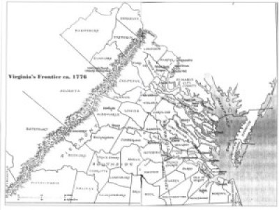 WOLF HUNTERS ON THE VIRGINIA FRONTIER, 1776-1818 [bounty lists & certificates from Amherst, Augusta, Bath, Botetourt, Grayson, Greenbrier, Hampshire, Hardy, Mopntgomery, Patrick, Pendleton, Rockbridge, Russell, Shenandoah, Washington, and Wythe counties [dates vary] transcribed & edited by Karen Wagner Treacy. 8 1/2 x 11, vi, 169 pages, full name index.
 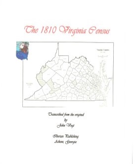 AMHERST CO., VA 1810 CENSUS transcribed by John Vogt. 10 1/2 x 8 1/2, x, 29 pages, illustrations, map, full name index. This is the first surviving
census for Amherst, since both the 1790 and 1800 censuses have been lost. The transcription is in the order in which the enumerator took his census. Thus, neighbors appear together and this will assist the
genealogist. Amherst was an important and populous county at the western edge of Virginia's Piedmont with a heavy slave population [5,600+].
AMHERST CO., VA 1810 CENSUS transcribed by John Vogt. 10 1/2 x 8 1/2, x, 29 pages, illustrations, map, full name index. This is the first surviving
census for Amherst, since both the 1790 and 1800 censuses have been lost. The transcription is in the order in which the enumerator took his census. Thus, neighbors appear together and this will assist the
genealogist. Amherst was an important and populous county at the western edge of Virginia's Piedmont with a heavy slave population [5,600+].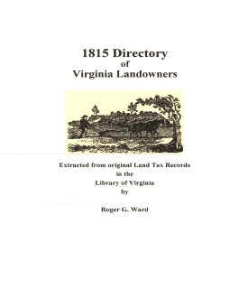 Amherst Co. 1815 Directory of Landowners
by Roger G. Ward. 2005.20 pages, map, 5 1/2X8 1/2.
Amherst Co. 1815 Directory of Landowners
by Roger G. Ward. 2005.20 pages, map, 5 1/2X8 1/2.